본문
|
Building HD map for Autonomous Driving
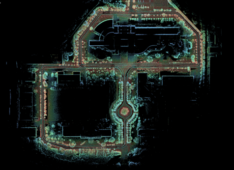
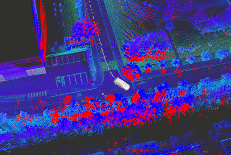
For autonomous driving, a map is essential for global path planning. In particular, it is important to create a map that includes road and lane information, such as an HD map or Lane(Vector) map, for assisting with lane tracking and localization. At the MSC research laboratory, a HD map is built in the KAIST Mun-ji campus based on LiDAR data transformed into the GPS UTM coordinate system for autonomous driving purposes. Global path planning, waypoint tracking and localization are being carried out based on vector map. Currently, MSC autonomous system is configured with LiDAR and GPS, but for the next-generation, we are building and performing localization based on advanced sensors, 4D radar and cameras.
Fig. 1. Produced Munji campus HD (Vector) map for autonomous driving.
Fig. 2. Vehicle position and pose estimation based on the HD map.
Robust 4D Radar Odometry and Mapping
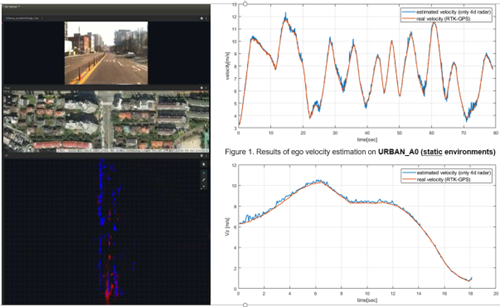
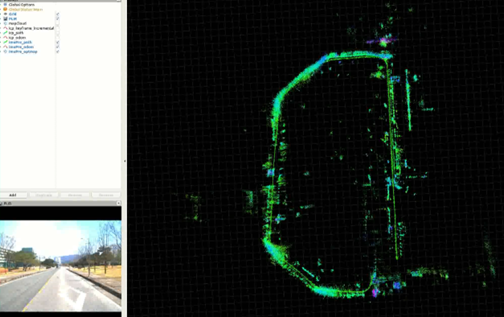
Due to their high resolution, most SLAM algorithms commonly adopt cameras and LiDAR as the primary sensors. However, SLAM algorithms based on these sensors are not robust in visually challenging scenarios such as nighttime or backlighting, as well as adverse weather conditions like rain, snow, and fog. In this context, radar has also been researched in the field of SLAM as an alternative sensor that can overcome such challenging environmental conditions. But performance of traditional radar sensor based SLAM techniques is limited to their low resolution, high noise and absence of height information. Recently, 4D radar, which overcomes these limitations, has gained attention as a key sensor for next-generation autonomous driving. In the MSC research lab, we are conducting research on robust SLAM algorithms that can handle adverse weather conditions and dynamic environments using this technology.
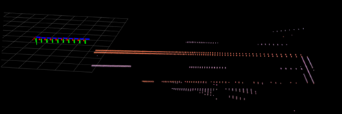
Fig. 3. 4D Radar based ego velocity estimation and stationary objects extraction (blue points)
Fig. 4. 4D Radar
odometry and mapping with IMU Preintegration
Lane and Road Marking SLAM from Lane Vector Factor
In the previous section, we explained the need for a map that includes Lane(Vector) for autonomous driving. Creating an lane map manually is a time-consuming and labor-intensive task. While LiDAR can create highly precise 3D maps, it is expensive for commercialization. At the MSC research lab, SLAM techniques are being studied that utilize cameras to automatically generate vector maps in real-time without the need for extensive time and effort. Most of the related research is currently focused on performing Inverse Perspective Mapping (IPM), which has a significant weakness in its susceptibility to pitch motion. Therefore, research in the direction of estimating the ground plane while optimizing odometry is being conducted.
Fig. 5. Odometry and
ground plane optimization from reprojected lane/road mark
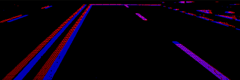
Fig. 6. Measured road
marking (blue) and re-projected road marking (red)
Fig. 7. Road marking reconstruction via optimization of keyframe odometry and ground plane
|

